GeoSolutions 亮相2026世界智慧城市大会,展示开源地理空间平台
2026年11月3日至5日,GeoSolutions 将参加在巴塞罗那 Fira Gran Via 举办的智慧城市博览会世界大会(Smart City Expo World Congress),作为意大利贸易署(ITA)组织的意大利展馆的一部分,展位位于2号馆 C161。届时,Eleonora Fontana 和 GeoSolutions 团队将在现场,与参会者探讨地理门户、城市数字孪生和开放数据基础设施等话题。如需预约洽谈,可发送邮件至 sales@geosolutionsgroup.com。
本届大会的主题是“从灵感到实施”,这与城市日常面临的挑战高度契合。大多数政府部门已经拥有数据:地籍、城市规划、交通、能源、民防、三维测量等。真正的难点不在于收集数据,而在于通过标准服务发布数据、与现有系统集成、为市民和部门提供易用的界面,并确保系统长期运行而不依赖单一供应商。这正是 GeoSolutions 借助 GeoServer 和 MapStore 两个开源平台所致力解决的问题。 雷恩大都会(Rennes Métropole)牵头,联合多个法国地方政府和机构,将 MapStore 打造为 geOrchestra 空间数据基础设施的查看器。项目为 MapStore 引入了应用上下文、地图目录和地图模板,以及地籍查询和城市规划专用工具。这些功能已在雷恩投入生产,并贡献到 MapStore 公共版本中,惠及所有采用该平台的城市。
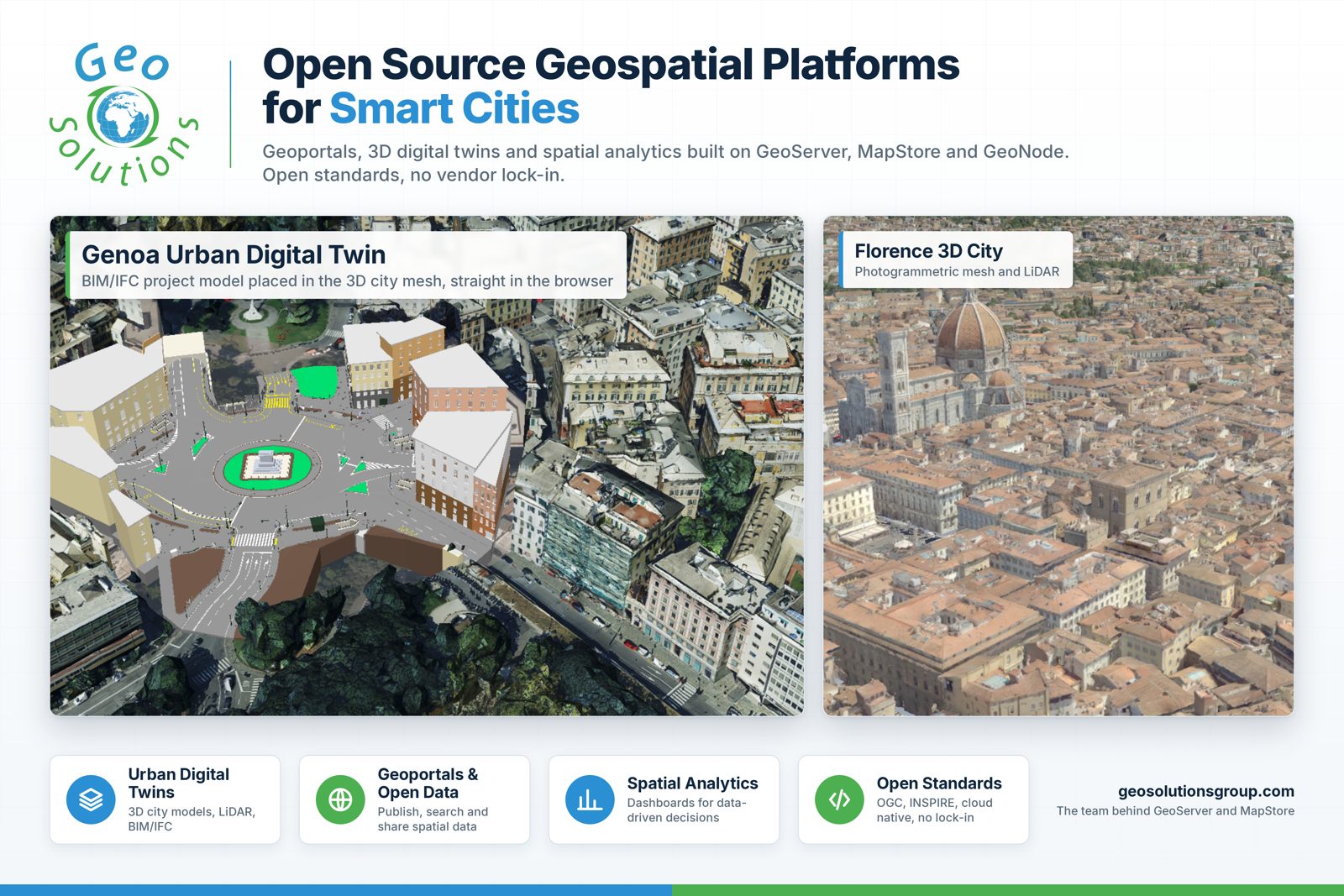
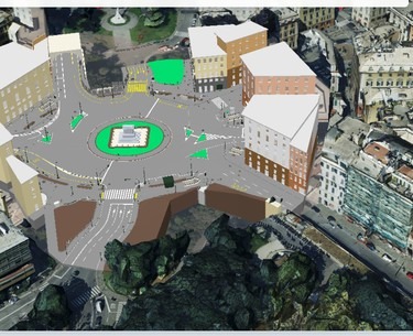
热那亚市运行着一个混合地理门户,MapStore 与集群化的 GeoServer 协同工作,并集成 GeoFence 实现细粒度访问控制、GeoWebCache 提供瓦片缓存,与现有的 Oracle 和 Active Directory 基础设施并存。市民使用意大利数字身份 SPID 登录。该平台发布民防数据、声学区划、地籍图层和能效地图,并提供雪灾应急、旅游、无障碍和能源等仪表板。它曾在常规流量之上实时发布选举结果。目前,热那亚正基于同一技术栈向城市数字孪生演进,将 BIM 和 IFC 模型直接带入浏览器中的三维城市视图。

佛罗伦萨市的 UNESCO 中心区数字孪生项目由 GeoSolutions 构建,包含从 LiDAR 提取的三维建筑、屋顶和树木等要素。处理流程采用开源的 Digital Twin Toolbox,将点云和网格转换为 OGC 3D Tiles,再由 MapStore 流式传输到任何浏览器,无需插件。

此外,GeoServer 还是赫尔辛基和维也纳等城市开放地理数据的引擎,这些城市通过 WMS 和 WFS 服务向开发者和市民发布数据集。MapStore 的三维城市数据能力可通过热那亚城市视图和米兰地下空间演示在线体验。 GeoServer 通过符合 OGC 和 INSPIRE 规范的服务发布栅格和矢量数据,支持从单一市政数据集到国家级基础设施,并借助 GeoFence 实现属性级安全控制、GeoWebCache 加速瓦片访问。MapStore 是 Web 前端,将交互式地图、仪表板、三维视图和地理故事整合在一个框架中,移动优先,可嵌入任何城市门户。GeoNode 则在城市需要完整开放数据平台时增加目录和数据管理层。三者均为开源,GeoSolutions 参与其指导委员会。 数字主权是许多政府机构的议程重点。对城市而言,这归结为几个实际问题:谁拥有运行数据的代码?数据存储在哪里?能否在不重写一切的情况下更换供应商或自行运行?借助开源平台和开放标准,答案很简单:代码公开,服务遵循 OGC 标准,部署可在本地或城市选择的云上运行,知识留在管理部门。没有随使用量增长的许可费,也没有锁定。 开源只有在出现问题时有人响应,才能在生产中发挥价值。GeoSolutions 的企业支持服务让城市及其系统集成商直接联系到编写 GeoServer 和 MapStore 的工程师,并提供明确的服务级别。部署订阅涵盖加固构建和升级,专业培训帮助团队快速上手。当城市需要产品尚未具备的功能时,GeoSolutions 会进行开发,并尽可能回馈社区,让其他城市受益,雷恩和 geOrchestra 的合作便是例证。 欢迎莅临2号馆 C161 意大利展馆,11月3日至5日,Eleonora 和团队将全程在场。如需提前预约会议,请发送邮件至 sales@geosolutionsgroup.com。欲了解完整技术细节和更多案例,请点击阅读原文。
编译自 GeoSolutions Blog,原文链接
原文摘要
Meet GeoSolutions at Smart City Expo World Congress 2026 (Hall 2, Stand C161): open source geospatial platforms for cities
Dear Reader, From November 3 to 5, 2026, GeoSolutions will be at Smart City Expo World Congress in Barcelona, Fira Gran Via, as part of the Italian Pavilion organised by ITA, the Italian Trade Agency. You will find Eleonora Fontana and the GeoSolutions team in Hall 2, Stand C161. If you are planning to attend and want to talk about geoportals, urban digital twins or open data infrastructure for your city, write to sales@geosolutionsgroup.com and we will book a slot at the stand. From inspiration to implementation The theme of this year's congress is "From Inspiration to Implementation", and it fits well with what we hear from cities every day. Most administrations already have the data: cadastre, urban planning, mobility, energy, civil protection, 3D surveys. The hard part is not collecting it. The hard part is publishing it through standard services, integrating it with the systems already in place, giving citizens and departments a usable interface, and keeping all of this running for years without depending on a single vendor. This is the ground we work on with GeoServer and MapStore, two open source platforms that we develop, maintain and support, and that are in production in cities across Europe and beyond. Urban digital twins and geoportals for cities, built on open source. Meet us in Hall 2, Stand C161. Cities that are already doing it A few examples we can share publicly. Rennes Métropole led the project that made MapStore the viewer of the geOrchestra spatial data infrastructure, together with Communauté d'agglomération du Puy-en-Velay, Région Hauts-de-France, Région Grand-Est and CRAIG. The work brought application contexts, map catalogues and map templates into MapStore, plus dedicated tools for cadastral consultation and urban planning. It is in production in Rennes and the features funded by these organisations are now part of the public MapStore release, available to every city that adopts it. Rennes Métropole: MapStore as the vi