QCity插件发布:在QGIS中实现城市开发建模
近日,North Road博客宣布推出QCity插件,这是一款将高级城市开发建模功能直接引入QGIS的新工具。该插件与澳大利亚西澳大利亚州珀斯的Canning市合作开发,旨在帮助城市规划者利用预定义框架对项目区域进行建模,并提供可视化的2D/3D洞察以及详细的统计报告。 QCity的工作流程从“项目设置”选项卡开始。用户可以定义新的项目区域边界,并输入住宅和停车(包括汽车和自行车)参数,或者加载之前保存的场地或QCity包。这一步骤为后续的详细建模奠定了基础。
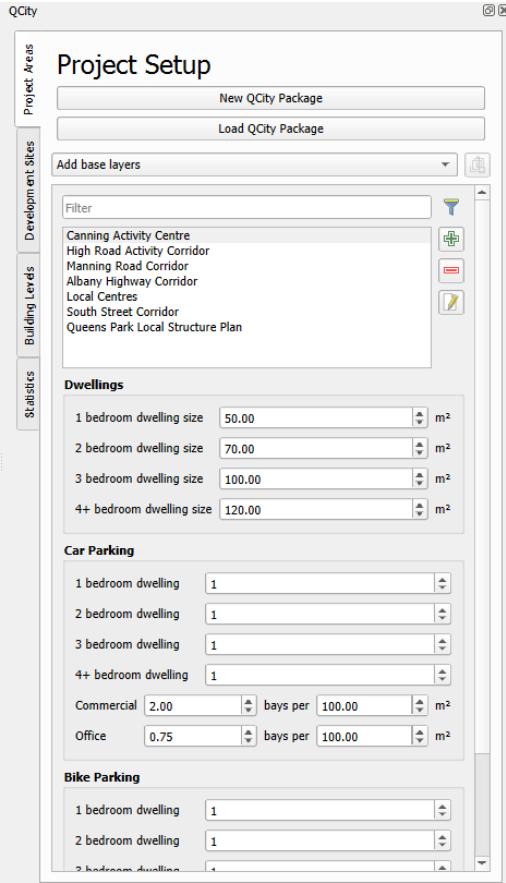
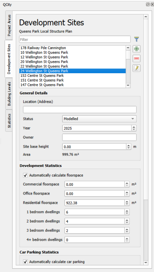
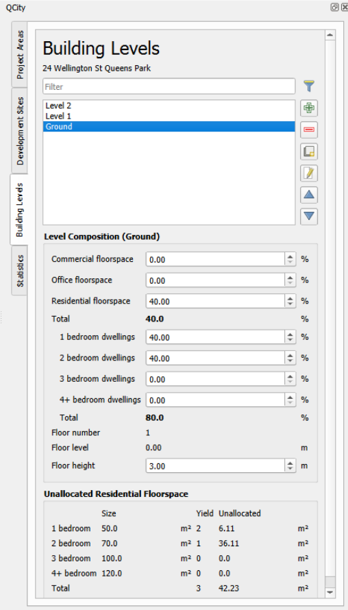
接下来,在每个项目区域内创建“开发场地”。开发场地选项包括多种类型,每个开发场地可以包含多个建筑层级,这些层级定义了建筑平面图和楼层。建筑层级包含用于确定每层构成的参数,例如商业、办公和住宅面积的比例等。
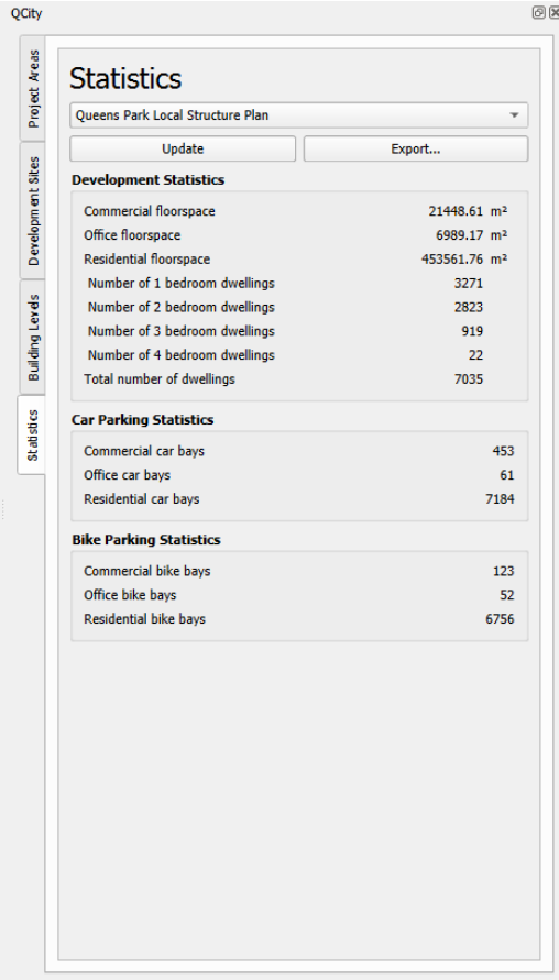
最后,系统会为整个项目区域计算统计数据,包括商业、办公和住宅总建筑面积、住宅数量以及汽车和自行车停车位的可用性。这些数据以直观的报告形式呈现,帮助规划者快速评估开发方案。
这是QCity的首次发布,因此目前作为实验性插件在QGIS插件库中提供。初始版本仅设计用于澳大利亚,但未来的开发将使其能够应用于世界其他地区。在QCity的代码仓库中,可以看到团队正在考虑添加的一些额外功能。需要注意的是,QCity需要QGIS 4.0或更高版本。 为了深入了解QCity的创建过程并观看功能演示,欢迎参加QGIS澳大利亚七月网络研讨会,届时Canning市高级战略规划空间分析师Gabriel Diosan将介绍“使用QCity在QGIS中进行城市开发建模”。 欲了解更多信息,请点击原文链接查看完整技术细节。
编译自 North Road Blog,原文链接
原文摘要
Introducing the QCity Plugin
Urban Development Modelling in QGIS Introducing QCity, a new plugin that brings advanced urban development modeling directly into QGIS. Developed in collaboration with the City of Canning (Perth, Western Australia), QCity enables urban planners to model project areas using predefined frameworks, providing visual 2D/3D insights and detailed statistical reports. The plugin workflow begins in the “Project Setup” tab, where users either define a new Project Area boundary and input dwelling and parking (both car and bike) parameters, or load a previously saved site or QCity package: Next, “Development Sites” are created within each Project Area. Development Sites options include: Setting the site’s status: constructed, proposed or modelled Automatic calculation of the site’s floor space, car and bike parking (based on […]