GeoNode 5.1.0 发布:扩展数据目录能力,强化权限管控
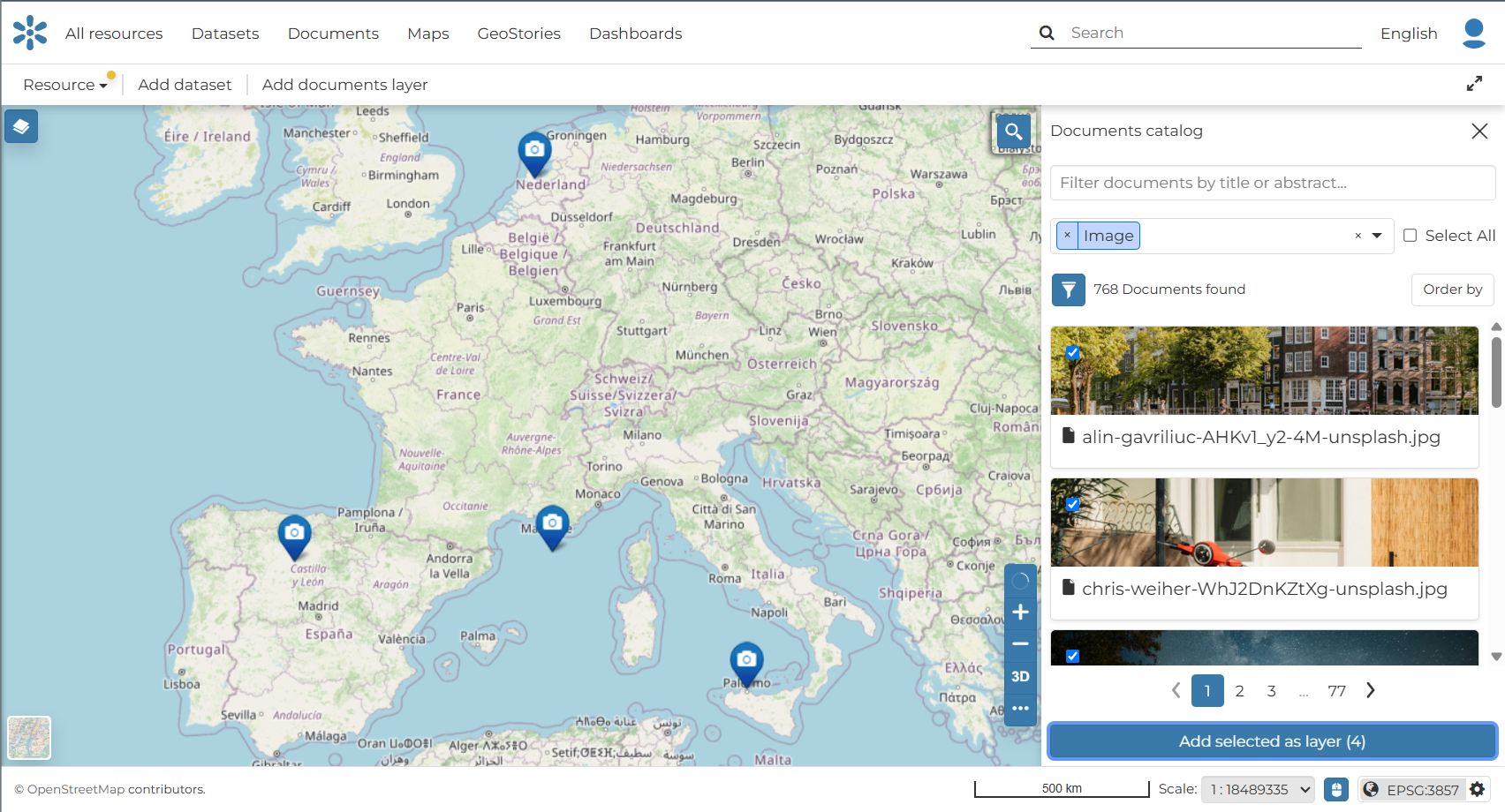
GeoNode 5.1.0 正式发布,这是基于全新 5.0 架构构建的首个功能版本。如果说 GeoNode 5 专注于重建基础,那么 5.1.0 则致力于让这些基础发挥作用。该版本显著拓宽了 GeoNode 可编目和发布的数据范围,并收紧了数据共享的控制措施。 本次发布贯穿两大主题:一是覆盖范围,GeoNode 现在能够处理完全不含几何信息的数据,以及始终留在远程服务器上的数据;二是控制能力,权限、外部资源认证和默认访问规则均得到大幅改进。此外,元数据国际化机制在整个平台范围内实现通用化,文档也启动了向全新 MkDocs 站点的迁移。 文档现在可以直接放置到地图上。用户可通过资源面板的“位置”选项卡手动设置地理位置,对于带有 EXIF 元数据的图像,GeoNode 会自动提取坐标。新增的“添加文档图层”按钮会打开专用资源浏览器,支持按类型搜索和筛选文档。选择并确认后,地图上会创建一个“文档图层”,每个文档对应一个要素,并以标记形式显示在其位置中心,点击标记即可在侧边栏预览资源。
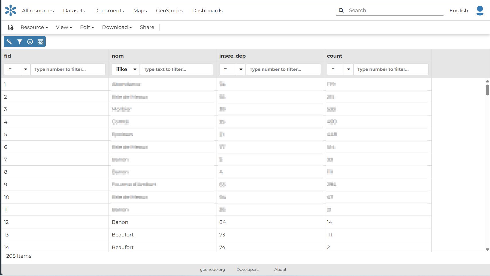
GeoNode 现在可以管理不含地理组件的表格数据。非空间 CSV 文件可通过标准资源管理工作流上传并注册到目录中,享有与空间图层相同的元数据、权限、搜索和下载行为。资源预览界面提供筛选和导出工具,主目录筛选面板也新增了“表格”复选框,用于过滤非空间数据。
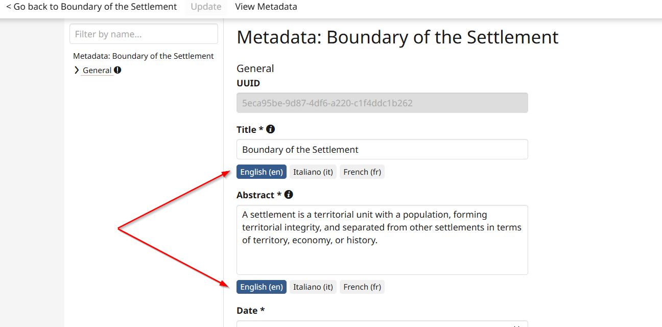
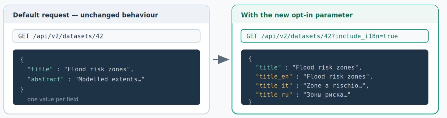
GeoNode 5.1.0 与 MapStore 合作,在客户端和目录中新增了对两种云原生格式的支持:用户提供 URL,GeoNode 仅读取所需内容。对于已向对象存储发布数据的组织,这消除了以往不可避免的重复步骤,权威文件保留在原处,GeoNode 就地编目和提供服务。同时,Microsoft Excel (XLSX) 成为支持导入和导出的格式,上传 XLSX 文件是可选的系统设置,管理员可决定是否启用。 元数据国际化机制经过重构和通用化,本地化标签和描述不再局限于 GeoNode 应用,元数据字段现在可以在整个平台上携带翻译。在 API 方面,新增可选参数 include_i18n,允许资源 API 返回所有可用翻译,同时保持向后兼容。相关改进还包括稀疏元数据字段的通用使用和叙词表管理的增强。
GeoNode 现在能正确处理同一图层中混合几何类型的数据集,确保更新和替换操作后源数据在存储和显示中保持一致。通用的认证层通过统一的 AuthConfig 模型支持多种类型(Basic、Token 和签名/SAS URL),凭据可跨集成重用。管理员现在可以为所有认证用户配置基线权限,远程资源的创建默认限制为管理员,并修复了私有数据集上意外的密码提示问题。
文档修订工作已在公开进行中,GeoNode 文档开始向新平台迁移。如需了解完整技术细节和详细更新列表,请点击原文链接查看发布说明。
编译自 Planet OSGeo,原文链接
原文摘要
GeoNode 5.1.0 Release
Dear Reader, Here is a closer look at , the first feature release built on top of the renewed 5.0 architecture. The list everything in detail. Where GeoNode 5 was about rebuilding foundations, 5.1.0 is about putting those foundations to work. It significantly broadens the range of data GeoNode can catalogue and publish, and it tightens the controls around how that data is shared.GeoNode 5.1.0release notes Two themes run through this release. The first is reach: GeoNode now handles data that has no geometry at all, and data that never leaves the remote server it is hosted on. The second is control: permissions, authentication for external resources and default access rules all received substantial attention. Alongside these, metadata internationalisation has been generalised across the platform, and the documentation has begun its move to a .new MkDocs-based site Documents can now be placed directly on a map. Geolocation can be set manually from the "Location" tab of the resource panel, or, for images carrying EXIF metadata, GeoNode picks up the coordinates automatically. A new "Add documents layer" button opens a dedicated resource browser where documents can be searched and filtered by type. Selecting one or several documents and confirming the action creates a "Document Layer" on the map, with one feature for each document chosen. Every document is shown as a marker positioned at the centre of its location, and clicking a marker opens a preview of the resource in the sidebar. This turns the map into a browsable index of related material, such as photos, reports and scans, anchored to the places they belong to, without leaving the map view to go looking for them. GeoNode can now manage tabular data with no geographic component. Non-spatial CSV files can be uploaded and registered in the GeoNode catalogue through the standard resource-management workflow, with the same metadata, permissions, search and download behaviour as any spatial layer. This opens GeoNode to